
If you’re visiting Santa Fe and looking for a quick escape into the mountains without the long drive, the Dale Ball Trails system deserves a place on your itinerary. Located just minutes from downtown, this network of interconnected paths offers everything from gentle morning walks to longer, more challenging outings, all within the foothills of the Sangre de Cristo Mountains.
We’ve created this guide to help you navigate the entire system. Whether you’re looking for an easy stroll after breakfast, a moderate afternoon hike, or a challenging ridge walk, Dale Ball offers clear markings, multiple route options, and views that remind you why you came to Santa Fe in the first place.
The Trail System at a Glance
The Dale Ball Trails comprise a 24.4-mile network of natural-surface paths, developed around 2001. Named after Dale Ball, who worked with the City of Santa Fe and community partners to develop the trail system, the network has grown into one of the region’s most accessible places for hiking, trail running, and mountain biking. Its proximity to downtown makes it particularly convenient for visitors who want to get outside without driving far into the mountains.
The network divides into three general sections: North, Central, and South. Each section can be explored independently, or you can string different trails together for longer adventures. A numbered junction system with posted orientation maps and directional markers helps hikers navigate the network, although carrying a current trail map is still a good idea.
Why you should hike Dale Ball trails:
- 24.4 miles of natural-surface trails
- Foothill terrain with substantial changes in elevation
- Trailheads accessible within minutes of downtown
- Year-round recreational opportunities, depending on weather and trail conditions
- Dog-friendly, with dogs required to be leashed
- Used by hikers, trail runners, and mountain bikers
Most of the Dale Ball system is managed by the City of Santa Fe, while portions of the southeastern system around Picacho Peak and Talaya Hill are managed by Santa Fe County. The Santa Fe Conservation Trust helps coordinate trail maintenance under agreements with the City and County.

Easy Options: Quick Hikes
Not everyone has four hours for a hike. The good news is that the northern Dale Ball trails and other accessible sections offer outdoor time without requiring half your day.
Dale Ball North: The Gateway Trails
Distance: Customizable depending on route
Elevation gain: Varies
Time: About 1–2 hours for many shorter routes
Difficulty: Easy to moderate
Best for: First-time visitors, quick hikes, families with older children, dogs
The northern section is a good introduction to Dale Ball. Start at the Sierra del Norte Trailhead and follow interconnected trails through piñon and juniper terrain, with periodic views back toward the city. You can adjust routes using the numbered junctions, letting you choose a distance that fits your time and ability.
What to expect: The northern trails are generally among the more moderate parts of the Dale Ball system. Posted junction numbers and maps help you create shorter or longer loops, and the foothill terrain offers a mix of rocky trail, vegetation, and views toward Santa Fe.
Pro tip: Take a current trail map or a photo of the trailhead map so you can keep track of your junctions as you go.
Ultra-Short Options: The Warm-Up
Distance: Customizable
Elevation gain: Varies
Time: About 1 hour, depending on route
Difficulty: Easy
If you only have an hour, you can use the numbered junction system near Sierra del Norte to create a shorter outing without committing to a full loop. This works well for a first hike after arriving in Santa Fe or when you want to fit a walk between other plans.
Extended North: Adding La Piedra Connection
Distance: Varies by route
Elevation gain: Varies
Time: 2+ hours depending on route
Difficulty: Easy to moderate
Once you’ve explored the northern Dale Ball trails, consider extending your hike using the La Piedra Trail connection. La Piedra connects to the Dale Ball network and offers another option for a longer route through the foothills.

Moderate Options: The Perfect Midday Hike
These trails are where many visitors find their sweet spot: enough climbing for a substantial hike without committing to one of Santa Fe’s longer high-elevation mountain routes.
Dale Ball Central: The Workhorse Trails
Distance: Customizable
Elevation gain: Varies by route
Time: About 2–3 hours for many moderate routes
Difficulty: Moderate
Best for: Solid afternoon hikes, hikers looking for more climbing
The Central section sits between North and South and offers more sustained climbing than some of the northern routes. You can access portions of this area from Sierra del Norte or Cerro Gordo, giving you several ways to explore the system.
The central trails move through typical Santa Fe foothill terrain, with rocky sections, vegetation, and viewpoints that open as you gain elevation.
What makes it moderate: You’re gaining real elevation, but many routes remain hiking trails rather than requiring technical climbing or scrambling.
Picacho Peak Trail: A Dale Ball Summit
Distance: Varies depending on route
Elevation gain: Significant
Time: Approximately 1.5–2.5 hours for common routes
Difficulty: Moderate
Best for: People who want a summit without an all-day commitment
Picacho Peak is one of the most prominent high points accessible through the southeastern Dale Ball trail network. At about 8,580 feet, it’s not particularly high by Santa Fe standards, but the climb offers broad views over Santa Fe and the surrounding foothills.
Trailhead: Cerro Gordo provides convenient access to trails leading toward Picacho Peak. Parking is limited, so consult a current Dale Ball map before your hike.
The climb: The trail climbs through rocky foothill terrain and becomes steeper as you approach the peak. Check the current trail map and route details before setting out, since distance and difficulty depend on the approach you choose.
At the summit: The high point provides expansive views toward Santa Fe and the surrounding mountain landscape.
Why Picacho Peak: It gives hikers a chance to reach a distinct summit without committing to one of the much longer high-elevation hikes deeper in the Sangre de Cristo Mountains.
Dale Ball South: The More Challenging Section
Distance: Highly variable depending on route
Elevation gain: Varies
Time: 2–4+ hours depending on route
Difficulty: Moderate to challenging
The South section connects with trails including Dorothy Stewart and routes toward Atalaya Mountain. Several access points allow hikers to explore this portion of the system without hiking all the way from the northern trails.
The South section includes steeper and more exposed terrain in places, with views extending across Santa Fe and the surrounding foothills.
Note: Southern access points include Dorothy Stewart, St. John’s College, and Wilderness Gate. Cerro Gordo also provides access to the central and southern portions of the larger trail network. Each offers a different way into this part of the system.
Challenging Options: Longer Adventures
If you want sustained mileage and climbing, Dale Ball accommodates that too.
Multi-Section Route: Stitching North, Central, and South Together
Distance: 10+ miles depending on route
Elevation gain: Varies significantly
Time: 4–5+ hours
Difficulty: Challenging
Best for: Strong hikers wanting a comprehensive Dale Ball experience
One way to see more of Dale Ball is to connect trails through the North, Central, and South sections in a single outing. You can begin around Sierra del Norte, move through the central network, and continue toward the southern trails.
Because Dale Ball is an interconnected trail system rather than a single defined long-distance route, your exact mileage and elevation gain will depend on the junctions you choose. Plan the route in advance using a current map.
Most routes don’t require technical climbing, so the challenge comes mainly from distance, elevation gain, rocky footing, and Santa Fe’s altitude.

Seasonal Character
Spring (April–May)
Spring conditions in the Santa Fe foothills vary considerably from year to year. Trails may be dry and pleasant or may still have snow, mud, or ice after late storms. Temperatures can also change quickly.
Summer (June–August)
Summer afternoons can be hot, and thunderstorms are common during the monsoon season. An earlier start can help you avoid the hottest part of the day and reduce your exposure to afternoon storms. Shade varies considerably across the trail system.
Fall (September–November)
Fall brings cooler conditions to the Santa Fe foothills. The Dale Ball system sits below many of the high-elevation aspen areas near the Santa Fe Ski Basin, but the comfortable temperatures and changing vegetation make it a popular season for hiking near downtown Santa Fe.
Winter (December–March)
Winter weather in the Santa Fe foothills is unpredictable. South-facing sections may dry relatively quickly after storms, while shaded and north-facing areas can retain snow or ice.
Parking & Logistics
Getting to Dale Ball Trails is straightforward, but the system has multiple access points. Knowing your options saves time.
Sierra del Norte Trailhead
Location: Along Hyde Park Road near Sierra del Norte/Cerros Colorados
Parking: Parking is available at the trailhead; availability can vary during busy periods
Best for: North and Central sections; convenient for first-time visitors
Directions from downtown: Follow Artist Road/Hyde Park Road toward the foothills and use current mapping or the Santa Fe Conservation Trust trail map to locate the Sierra del Norte access point.
Why use this trailhead: Sierra del Norte provides convenient access to some of the more moderate northern and central Dale Ball trails.
Cerro Gordo Trailhead
Location: Near the intersection of Upper Canyon Road and Cerro Gordo Road
Parking: Limited parking
Best for: Picacho Peak and access to Central and South portions of the system
Directions from downtown: Follow streets east from central Santa Fe toward Upper Canyon Road and Cerro Gordo Road. Use a current map for the exact trailhead location.
Why use this trailhead: It provides convenient access to trails leading toward Picacho Peak as well as other portions of the Dale Ball system.
Important: Parking can be limited, especially during popular hiking periods. Have an alternate access point in mind if necessary.
Dorothy Stewart Trailhead & Other South Access Points
Location: Southern Dale Ball access is available from several locations, including the Dorothy Stewart, St. John’s College, and Wilderness Gate areas
Parking: Varies by access point
Best for: South section and connections toward Dorothy Stewart and Atalaya
When to use: If you specifically want to explore the steeper southern terrain or connect Dale Ball with adjacent trails.

Multi-Use Trails: Hiking, Biking, and Trail Running
The Dale Ball Trails system welcomes hikers, mountain bikers, and trail runners. This multi-use character is part of what makes the system so useful for outdoor recreation close to Santa Fe.
For Mountain Bikers
Mountain bikers use many sections of Dale Ball. Key points:
- Route choice: Difficulty varies considerably throughout the network
- Difficult sections: Rocky and steep areas can be technically demanding
- Trail etiquette: Follow posted trail etiquette, control your speed, and yield as required
If you’re considering riding Dale Ball, consult a current trail map and choose a route appropriate for your technical ability.
For Trail Runners
Dale Ball’s interconnected trails, moderate-distance options, and numbered junctions also make the system useful for trail running.
- Route options: North, Central, and South sections provide different combinations of distance and climbing
- Navigation: Numbered junctions make it easier to plan and follow a route
- Trail etiquette: Stay aware of hikers, cyclists, dogs, and other trail users, and follow posted right-of-way guidance
Trail Conditions & Safety
Navigation
The Dale Ball Trails system’s numbered junction system is one of its biggest advantages. At many junctions, you’ll find:
- A map showing nearby junctions
- Directional markers indicating connecting trails or trailheads
- Clear junction numbering
What this means: Navigation is easier than on many unmarked trail networks, but carrying a current map or downloading one from the Santa Fe Conservation Trust before leaving is still recommended.
Water
Do not rely on finding drinking water on the trail. Carry enough water for the distance, weather, altitude, and level of exertion involved in your route.
Sun & Altitude
- Sun protection: Shade varies throughout the system, and exposed sections can receive strong sun. Sunscreen, a hat, and sunglasses are useful year-round.
- Altitude: Dale Ball sits at elevations considerably higher than many visitors are accustomed to. If you’re arriving from a lower elevation, take it slower than you would at home and pay attention to how you feel.
Weather
Afternoon thunderstorms are common during Santa Fe’s summer monsoon season. Check the forecast before leaving and avoid exposed terrain when thunderstorms threaten.
Winter storms can leave snow and ice on portions of the trail system, particularly shaded and north-facing sections. Check current conditions and carry appropriate traction if necessary.
Wildlife
Dale Ball passes through natural foothill habitat, so wildlife encounters are possible. Give animals plenty of space, keep food secured, and follow local wildlife guidance.
Dogs are allowed but must be leashed.
Best Practices
- Plan ahead. Review the weather and your route before leaving.
- Tell someone where you’re going. It’s good practice on any trail.
- Carry enough water. Adjust the amount for your route, temperature, and level of exertion.
- Bring a headlamp on longer outings. It provides a backup if your hike takes longer than expected.
- Check conditions before going. The Santa Fe Conservation Trust and City of Santa Fe provide current maps and trail information.

Your Santa Fe Base: Four Kachinas Inn
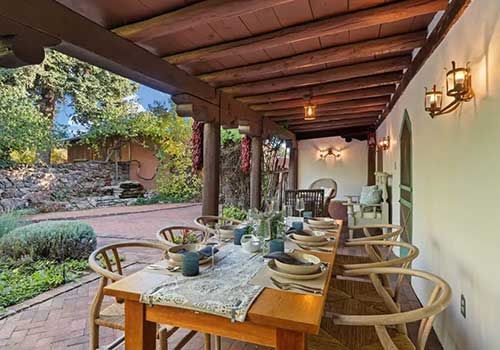
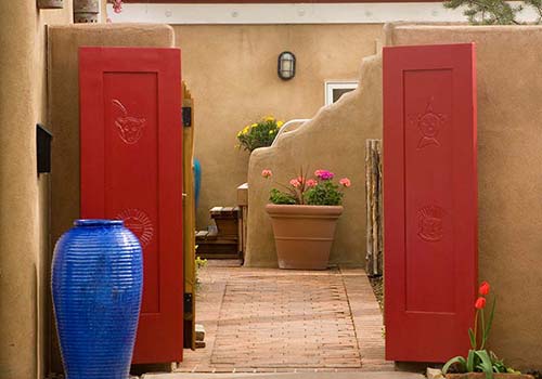
If you’re planning to explore the Dale Ball Trails or the broader Santa Fe hiking scene, our Bed and Breakfast in Santa Fe, NM, provides a convenient base in the city’s downtown historic area.
Four Kachinas Inn, located at 512 Webber Street, is within walking distance of the Plaza, galleries, restaurants, shops, the State Capitol, and other downtown attractions. The Dale Ball Trails are close enough to downtown that you can spend part of the day hiking and still return to Santa Fe with plenty of time to enjoy the city.
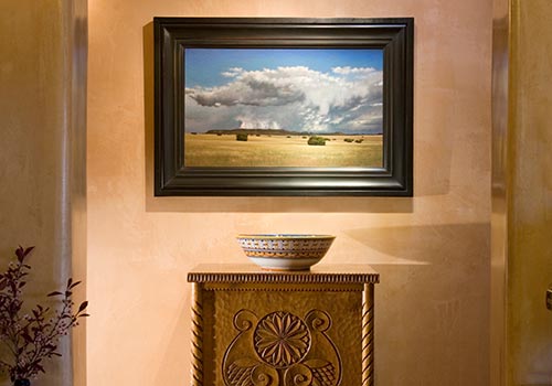
After a day on the trails, settle into one of six guest rooms featuring regional art, handcrafted furnishings, private baths, and modern comforts. The inn also serves a complimentary homemade breakfast each morning, giving you an easy start before heading back out to explore Santa Fe. Ready to plan your Dale Ball adventure? Book your stay today!